Explore Our Area’s Many Hiking Trails
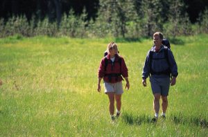 The Western North Carolina area boasts some of the most pictureque hiking trails in the United States.
This is a list of some of the trails in North Georgia and western North Carolina, including the Cashiers-Highlands area. The views and scenery from these hiking trails and mountaintops are spectacular! Escape from the city and enjoy the beautiful Blue Ridge and Smokey Mountains. Within a very short drive from the crossroads in Cashiers, you can be at any number of trailheads or crossing points in no time.
The Bartram Trail
One of North Carolina’s long-distance trails and one of the state’s great hiking treasures. The trail stretches 100 miles starting in South Carolina, passing into Georgia, and ending in the Nantahala National Forest of North Carolina. There’s plenty of terrific day hikes along the trail, one popular in the Cashiers-Highland area is the:
Bartram Overflow Creek Loop
- Length: 3.5 mile loop
- Rating: More difficult
- Trail head: The Osage Overlook.
DIRECTIONS (from Highlands): From U.S. Highway 64 and NC 106 in Highlands drive west 5.7 miles to the Osage Overlook.
Chinquapin
Take the trail on the right from the Glen Falls parking area. The trail travels along a tributary, crossing numerous times. It can be wet and slippery! At the top of the ridgeline, which is approximately 4200 feet, are 3 overlooks with views of the Blue Valley.
- Length: 3.5 miles (round trip).
- Rating: Moderate
- Trail head: Glen Falls parking area.
DIRECTIONS: U.S. Highway 64 west to Highlands. Turn right at the second traffic light and left onto Highway 106 south. Go approximately 3 miles and turn left onto Glen Falls Road. Road dead-ends about a mile down in a parking lot.
Panthertown Valley
Panthertown Valley is a treat for hikers, as it contains a curious mixture of threatened and endangered species and natural communities. Panthertown is distinguished by its broad flat valley floor flanked by granite cliffs abruptly rising 200 to 300 feet. These granite domes with exposed rock are uncommon in the southern Appalachians and offer spectacular open vistas. The unusually flat valley is home to at least 11 different natural communities, including the rare southern Appalachian bog and the swamp forest-bog community. These communities harbor numerous rare plants, such as Cuthbert’s turtlehead, Canada burnet, marsh bellflower, climbing fern, and spinulose wood fern.
The headwaters of the East Fork of the Tuckasegee River and 20 miles of native brook trout streams, including Panthertown, Greenland, and Flat Creeks, are located in Panthertown Valley. Hiking on the old logging roads of Panthertown is a good way to familiarize yourself with this large scenic valley. A network of hiking trails will lead you to waterfalls and spectacular overlooks of the valley, its cliff faces, and bogs. The waterfalls have a wet microclimate supporting the highest concentration of rare plants in the valley.
Please be aware that there are many sensitive areas in Panthertown Valley. Hikers can lessen their impact by staying on designated trails. The rare ferns, mosses, and liverworts near the waterfalls are easily scraped off the rocks when visitors walk behind the falls. For this reason, the U.S. Forest Service encourages visitors to view the falls from below.
Primitive overnight camping and catch-and-release fishing are allowed in Panthertown, so you can spend a full weekend in this wild area.
DIRECTIONS: There are several entrances to Panthertown Valley, but the most accessible route is as follows: Approximately two miles east of Cashiers on U.S. Highway 64, turn left or north on Cedar Creek Road (SR 1120). Continue on Cedar Creek Road 2.2 miles. Bear right or northeast on Nicholson Lane (SR 1121). Continue 3.4 miles on SR 1121 to a flat parking area at a gap where the National Forest boundary begins. The access road from the gap makes an excellent foot travel path. No motor vehicles are allowed beyond this point.
Silver Run Falls Trail
A easy and short trail leads to the falls from Highway 107. Nearly as wide as it is tall, Silver Run Falls, tumbles over a rock ledge.
- Length: 0.3 miles
- Rating: Easy
DIRECTIONS: Silver Run Falls is located 4 miles south of Cashiers on North Carolina 107
Sunset Rock
This is an ideal short ½ mile walk, perfect for really a stroll in the Highlands area. The trail leads to a natural cliff side amphitheater and absolutely beautiful sunsets.
- Length: .06 miles (round trip).
- Rating: Easy
- Trail head: Horse Cove Rd., across from the Highlands Nature Center.
DIRECTIONS (from Cashiers):
Take U.S. Highway 64 west to Highlands – at the light on Main Street turn left. Travel 1/2 mile to Nature Center on your left.
Whiteside Mountain
The trail takes you on a hike to 4,940 ft. elev. along the eastern Continental Divide, which offers spectacular views from a high ridge top, 2,100′ above the valley floor. Whiteside Mt. has the highest sheer cliffs in the Eastern US.
- Length: 2 mi. loop.
- Rating: Easy to moderate
- Trail Head: Whiteside Mt. parking area.
DIRECTIONS: From the intersection of N.C. 107 and U.S. 64 in Cashiers, drive west on U.S. 64 in the direction of Highlands. After 4.7 mi. on U.S. 64, turn left on Whiteside Mountain Rd. (SR 1690) at brown “Whiteside Mountain Trail” sign. Continue 1.1 mi., passing Wildcat Cliffs Country Club on right. Turn left into gravel parking lot.
Yellow Mountain
There are steep ascents and descents to old stone and wood fire tower which is recognized as a National Historic Lookout, at 5,127 ft. elevation. At the top..the reward is a beautiful 360-degree view.
DIRECTIONS: From the intersection of N.C. 107 and U.S. Highway 64 in Cashiers, drive west on U.S. Highway 64 in the direction of Highlands. After 7.3 mi. on U.S. Highway 64, turn right on Buck Creek Rd. Go 2.2 mi., passing Chestnut Hill on right. Look for a steep path on right with a small wooden sign and steps leading to the trail. Park on left in gravel. If you pass Cole Mountain Circle, you’ve gone too far.
- Length: 4.8 mi. round trip
- Rating: Strenuous
- Trail head: Right side of Buck Creek Road
DIRECTIONS: Drive east on US 64 from Highlands North Carolina 2.7 miles and turn left onto Buck Creek Road. Continue 2.3 miles up to Cole Gap. There is a sign and steps at the trailhead on the right side of Buck Creek Road.
Whitewater Falls
Whitewater Falls, also called Upper Falls, is one of the highest falls east of the Rockies at 411 feet. This waterfall is designated a North Carolina Natural Heritage Area and it is accessible via a short 0.2 paved path off NC 281. The Foothills Trail passes near the Upper Whitewater Falls and this route is a loop hike that combines the Foothills Trail with a spur trail that crosses NC 281 near the Whitewater River bridge. There is a designated campsite along the spur trail and a few other sites that are suitable for small groups that are looking for a nice overnight loop hike in this area.
- Length: 5.1 Miles
- Rating: Moderate
- Trail Head: NC 281
- Trails used: Foothills, Spur Trail
DIRECTIONS (from Cashiers): Drive south on NC and SC 107 9.3 miles to SC 413 and a sign for Whitewater Falls. Turn left and continue 2.3 miles to the intersection with SC 130. Hake another left and drive north on SC 130, which becomes NC 281 at the state line. Just beyond the state line is a sign for Whitewater Falls. Visitors coming from Toxaway and other points east should start at US 64 and 281 and drive south 8.6 miles to the Whitewater Falls parking area. New toilets are near the parking area.
Western North Carolina Hiking in the Region
Crabtree Falls
This popular, short loop descends moderately to a majestic 70′ waterfall, which has been touted as one of the most photogenic in the area. You’ll climb steeply up the opposite ridge for a short distance, then hike a wide, smooth trail beside the stream. Many very large trees grace the forest in this area. Finish out the loop by climbing gently through a beautiful hardwood forest. Can you find the Fraser Magnolia, which has the largest leaves of any tree in the woods? Starts in a Blue Ridge Parkway campground which makes a good base camp for further explorations into the area.
- Length: 2.5 mi
- Rating: Moderate
DIRECTIONS (from Asheville): Follow the Blue Ridge Parkway north for 41 miles to the Crabtree Meadows area. Turn left and head into the campground at milepost 339.5. (If the campground is closed, you may park outside the gate as long as you don’t block it. This adds 0.1 miles to the hike.) The signed trailhead parking lot is on the right just before the campground’s pay station.
Harper Creek Waterfalls
A wilderness experience awaits along Harper Creek. However, this is a relatively gentle encounter with wilderness due to its short length, moderate grade, and sparse (but useful) trail blazes. From intimate creekside scenes, to long-distance views, to close-up encounters with two major waterfalls, excellent scenery lies along this hike. You’ll follow a major, free-flowing stream for several miles and cross it a total of 12 times, getting you wet up to your knees. Not recommended in winter or during high water.
- Length: 8.5 mi
- Rating: Most Difficult
DIRECTIONS (from Asheville): Take I-240 East to I-40 East through Black Mountain and down the mountain to Morganton. Take Exit 100 (Jamestown Rd.). Turn left at the end of the ramp. At the third traffic light, turn left onto NC 181 north. Follow 181 for about 12 miles to Brown Mtn. Beach Rd., at a church, and turn right. Go about 5 miles; just past a bridge over Wilson Creek (which looks like a small river) turn left to stay on Brown Mtn. Beach Rd. The main road continues straight but changes names. There is a sign for the Pisgah National Forest Mortimer Campground. You will follow Wilson Creek through the settlement of Brown Mountain Beach, then into its beautiful Gorge section, and the visitor center is on the left after approximately 4-1/2 miles
Sam Knob
At the top of a spectacular mountain peak located at the edge of the Shining Rock Wilderness, spectacular views await! A surprisingly nice, easy trail wraps around this mountain to its grassy, partly bald summit. Hike in the late summer and enjoy a snack of mountain blueberries along the way. Any time of year, enjoy one of the finest short hikes and easiest true “summit” trails in the mountains!
Access to this area is from Black Balsam Road (FR 816) along the Blue Ridge Parkway. There are two main parking areas along Black Balsam Road: one at the gap and crossing of the Art Loeb/Mountains to Sea trails, and the other at the end of the road about 0.5 mile past the gap where half a dozen other trails start.
- Length: 2.2 mi
- Rating: Moderate
DIRECTIONS (from Asheville): Take the Blue Ridge Parkway South past Mount Pisgah, US Highway. 276, and Graveyard Fields. Just past milepost 420, look for the road to Black Balsam (FR 816) on the right. The (semi) paved road travels about 0.8 miles to the first parking area where the Art Loeb and Mountains to Sea trails cross. This is the easiest route to the top of Black Balsam itself. The road travels down another 1/4 mile to the Black Balsam Parking Area, where there are pit toilets, informational signs, and several trailheads.
Summit Trail/Rhododendron Trail
This mountaintop self-guiding nature trail is a gem in North Carolina’s northwest corner. You’ll see rare Northern Red Oak forests at an elevation near 5000′, as you stroll through an understory of Catawba rhododendron, which put on a showy display during June. And at one of the most spectacular of several cliff-top views, you’ll find a heath bald with rare plant species, and a rare, misplaced Aspen forest!
Located in the far northwest corner of North Carolina, unique Mount Jefferson rises more than 1600′ above a broad, high plateau to its northeast to reach nearly 4700′ in elevation. Traveling north to south, it marks the beginning of a cluster of high mountains along and east of the Blue Ridge stretching to the southwest, including Beech Mountain, Sugar Mountain, Roan Mountain, Grandfather Mountain, Big Bald, and Mount Mitchell. North of Mount Jefferson the higher mountains shift west to the state lines and include Mount Rogers in Virginia, which is the last peak above 5000′ in the Southern Appalachians if you continue north.
- Length: 1.5 mi
- Rating: Moderate
DIRECTIONS (from Boone): Follow US 221/421 until US 221 splits left (north). The road to the park is on the right after you pass through West Jefferson. Follow the signs
Links of Interest: